WW2 gunship HMS Medusa set sail for France with the D-Day memorial flotilla, and set about finding the wreckage of HMS Magic using Raymarine Sonar technology
Thursday - 01 August 2024
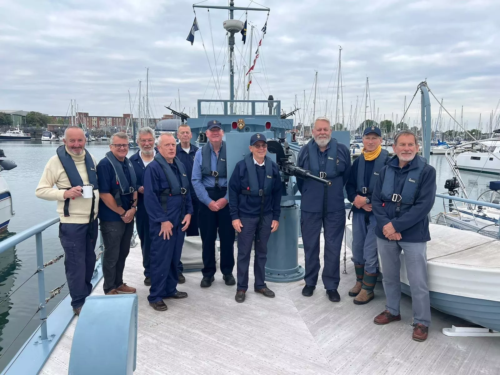
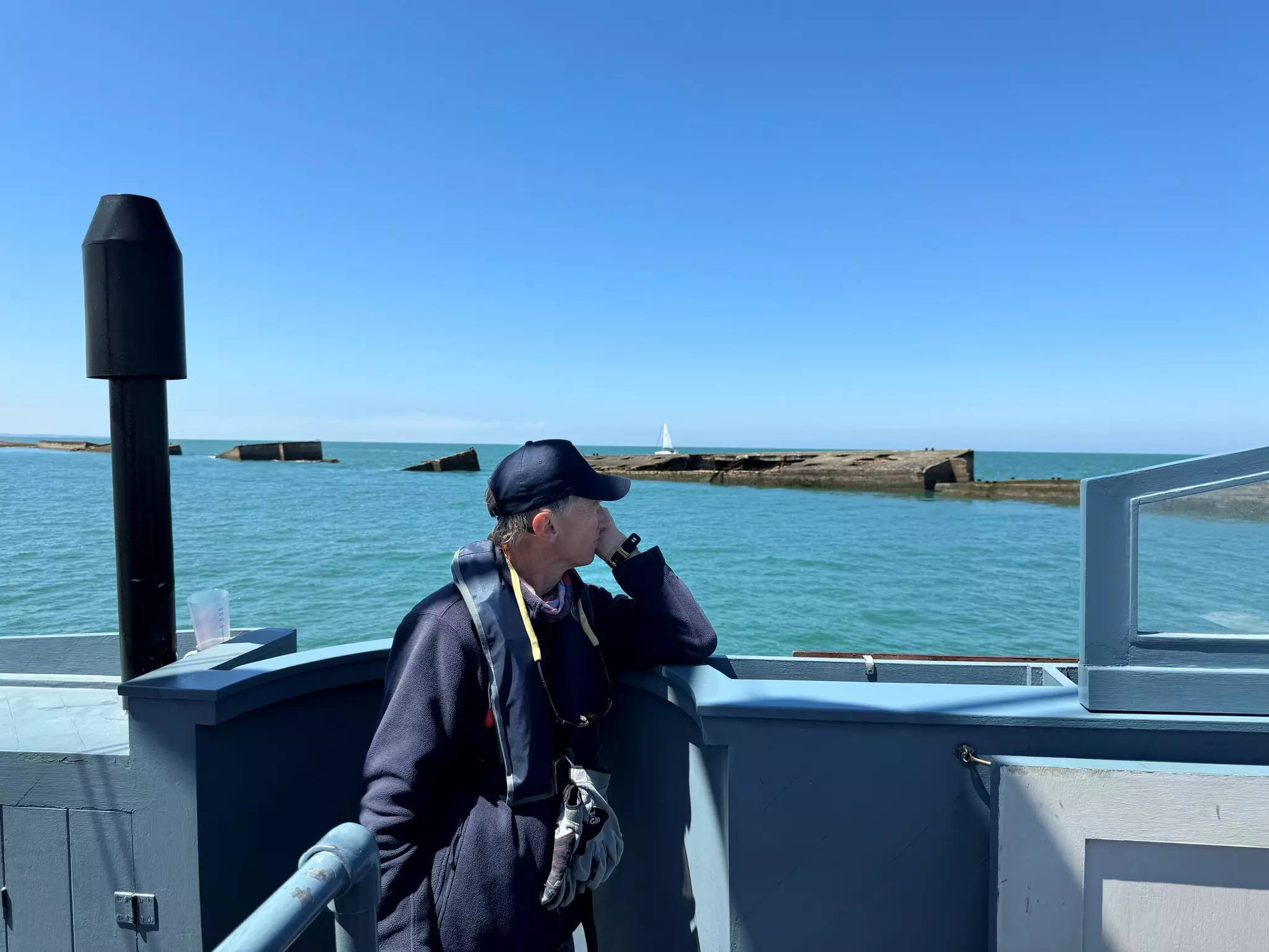
Alan Watson OBE has been a volunteer on HMS Medusa for nearly 30 years and her captain for 12 years. For almost 20 years he delivered customer training for Raymarine and has been a product tester for much of that time. His background is as a radio and electronics officer in the Merchant Navy and, as well as Medusa, he skippers training vessels for the Royal Navy Combined Cadet force and his own boat, a Nelson 42 “Trinity Star”.
In this post, Alan talks us through the historic journey that HMS Medusa took in 2024...
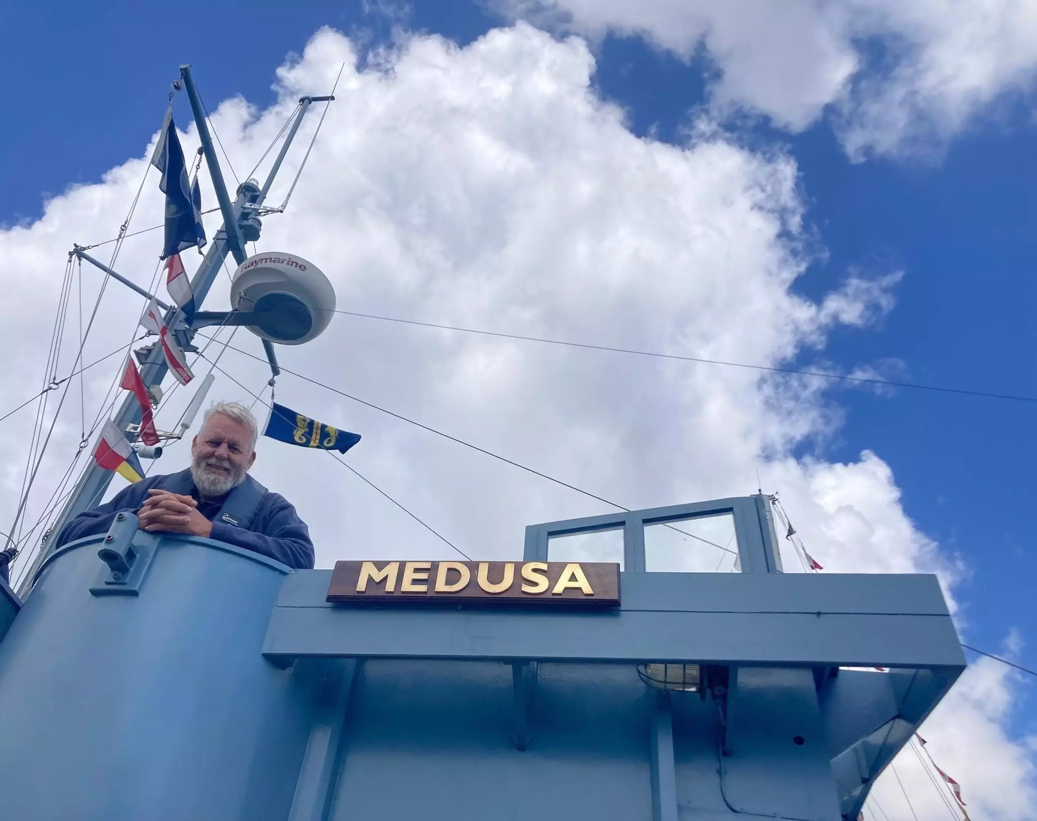
HMS Medusa, now 81 years old, was one of the first ships to leave the UK for D-Day on 6th June 1944. She departed Portland on the 4th to mark a position on the edge of a minefield off the D-Day beaches. During the evening of 5th June, she acted as a homing beacon for minesweepers to clear a channel through to Omaha beach and then marked the entrance to the channel for the invasion fleet before going in close to the beaches herself.
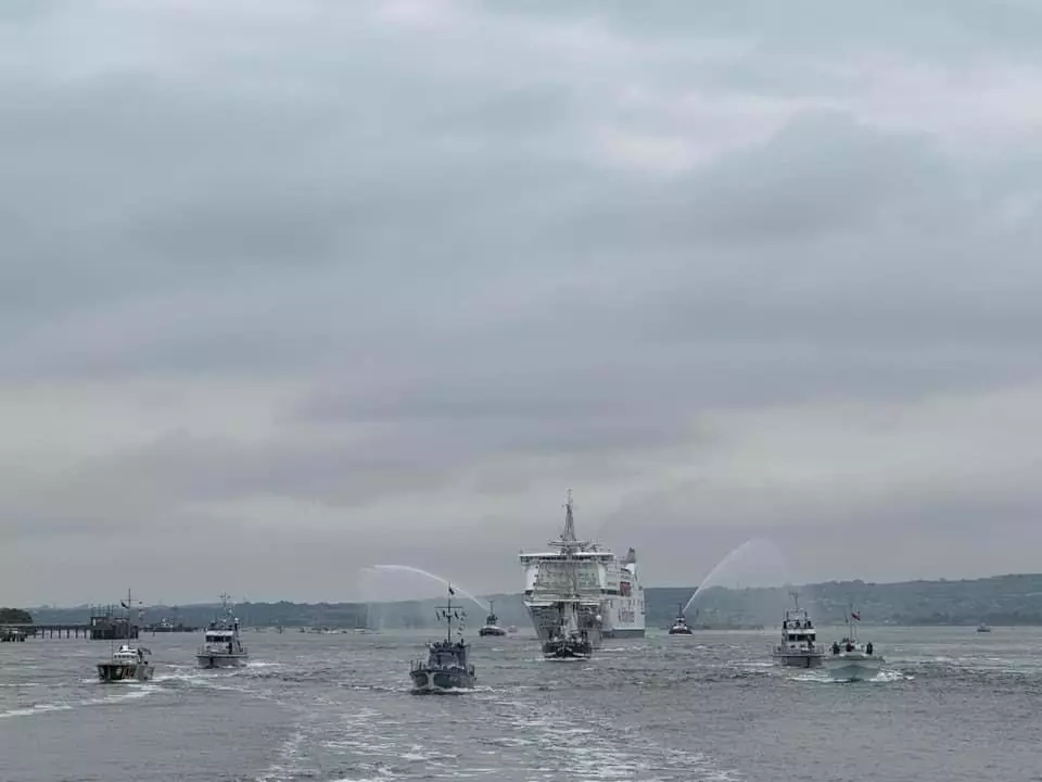
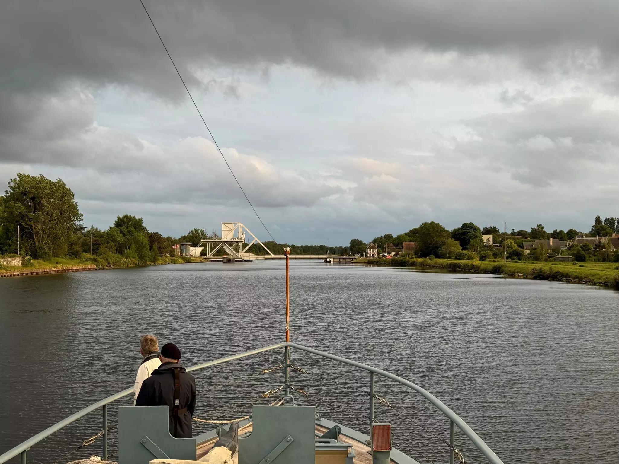
Eighty years on we wanted to revisit the beaches and retrace her steps. It was an incredible experience and particularly poignant for two of our crew members. On the morning of 4th June we led a flotilla of ships out of Portsmouth, including the ferry Mont St Michel, carrying veterans and the Freedom Flame which we had escorted in two weeks previous on its journey from the Arc du Triomphe to D-Day locations. We continued across the Channel and spent the 6th June adjacent to Pegasus bridge before departing on the 7th.
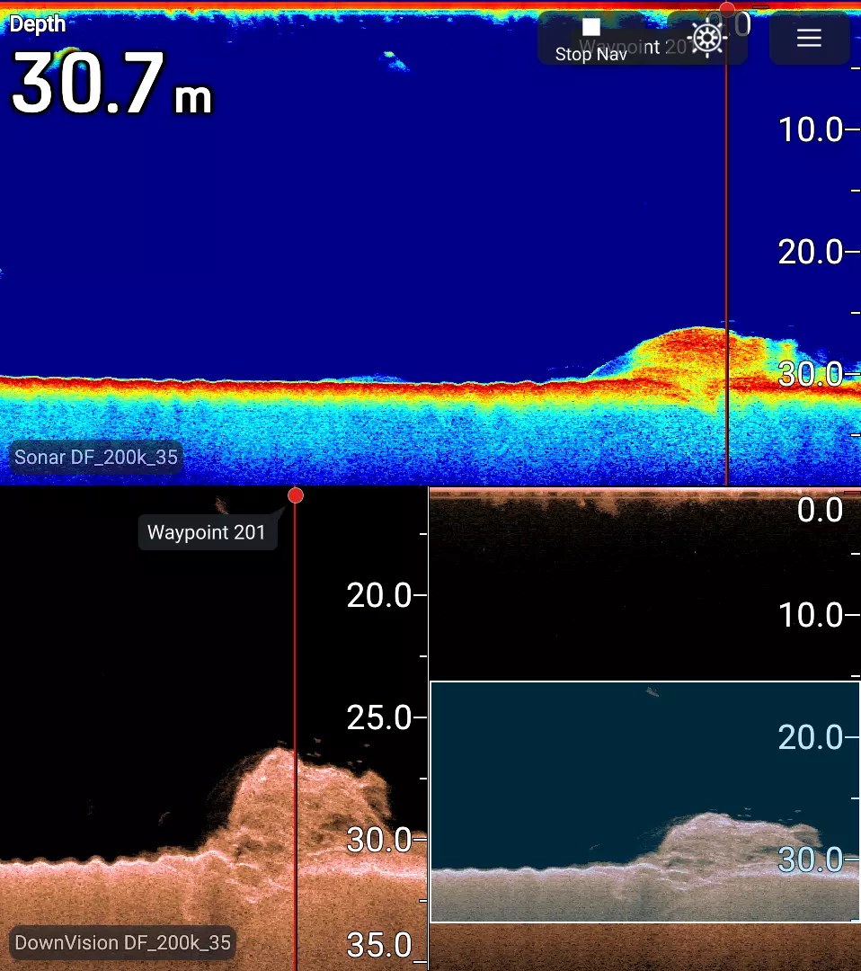
Our next objective was to find the wreck of HMS Magic, roughly 10 miles north of Ouistreham. Magic was torpedoed on 7th July 1944, with considerable loss of life. The father of one of our crew members, Richard Hobbs, was aboard her that night and survived.
Locating the wreck is no easy task; though it is marked on the chart, the position is not accurate. We first of all searched using the Raymarine CP100 in “fish finder” mode, and then once located used “downvision” to give a higher resolution image. The wreck is laying on its side, and damage from the torpedo strike was visible. Once located we held a short service for those that did not come back and are still aboard.
From there we proceeded to the Mulberry harbour at Arromanches. This is quite a tight entrance with plenty of obstacles both above and below the surface. Medusa was damaged here in 1944 and we did not want to repeat the experience. A combination of the chartplotter and accurate bottom data was a huge help.
Next stop was Point du Hoc. Another of our crew, Mark Fowler, had a family connection; his father was in the Fairmile B that led the US Rangers into the point on D-Day. Mark still had his father’s chart from D-Day so we entered the course line into the Axiom chartplotter and followed it in. Using the chartplotter made it easy to compensate for the tide, something they struggled to do on D Day.
From there we went to Grandcamp Maisy, a tiny fishing port entered over a mile long ledge that dries for a good bit of the tide. Again having accurate depth information from the Raymarine kit relieved the stress and risk of grounding.
Our voyage ended with visits to Cherbourg, Portland, and then back home to Gosport. We came back with a better understanding of what they did 80 years ago, and though they had cutting edge electronic navigation of the day, our kit would have made their task so much easier.
Find out more about HMS Medusa at hmsmedusa.co.uk